Chouteau’s Island history still very much alive

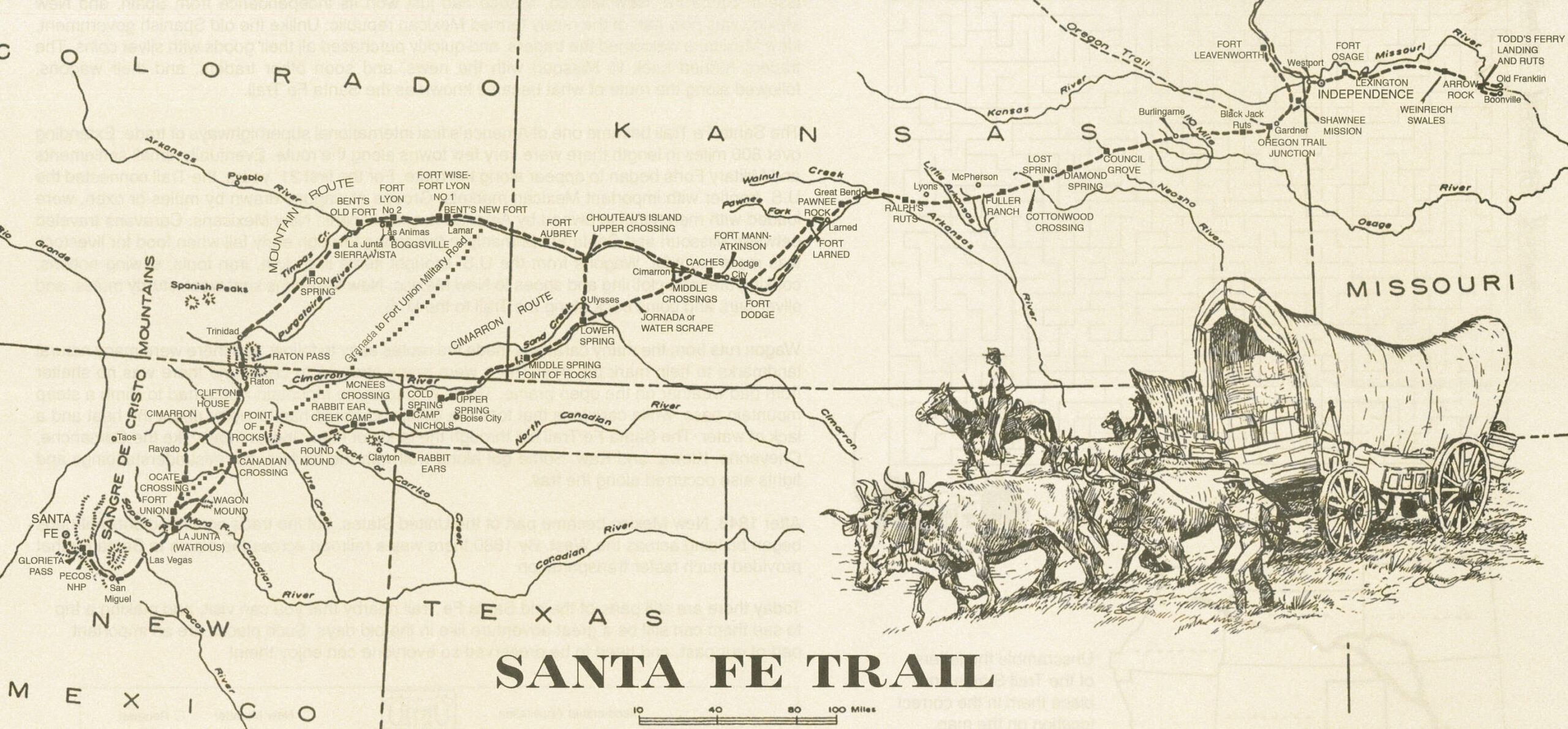
Chouteau’s Island was the site of a number of skirmishes, and it was one skirmish in particular that earned the island its name. In the spring of 1816, Auguste P. Chouteau and his hunting party were returning from the upper Arkansas in Colorado with a winter’s catch of furs when they were attacked by a band of 200 Pawnee Indians. They retreated to the island where the grove of cottonwood trees, thick clumps of willows and a heavy growth of tall grass provided excellent coverage. Despite being considerably outmanned, Chouteau’s party successfully fought off their attackers. One man was lost and three others wounded.

In 1828, more than $10,000 of silver was buried at Chouteau’s Island by a group of traders known as the Milton Bryan Party. The group was on the return trip from Santa Fe, and among Bryan’s party was a man by the name of William Young Witt. Witt, a third cousin to the grandmother of B.C. Nash, a lifetime Lakin resident, kept a diary of the journey. One morning after arriving at the Upper Cimarron Springs, Bryan’s party was awakened just before dawn.

“The whole earth seemed to resound with the most horrible noises that ever greeted human ears; every blade of grass appeared to re-echo the horrid din,” Witt wrote. “In a few moments every man was at his post, rifle in hand, ready for any emergency, and almost immediately a large band of Indians made their appearance, riding within rifle-shot of the wagon. A continuous battle raged for several hours.”

After successfully stampeding all the horses and mules, the Indians retreated. Hitt was wounded six times. (According to Bryan’s account and Hitt’s son’s account, Hitt was wounded 16 times.) The next morning, some of the men took off in hopes to find the lost stock. Hitt was on his way back to camp when he was overtaken by Indians, but some of his traveling companions arrived in time to save him. Unable to secure any of their stock, the entourage left by foot in the morning with each man shouldering a rifle and a proportion of provisions. After eight days travel, they had less than 100 pounds of flour left and had been unsuccessful in finding any game.

Hitt recalled, “For two weeks the allowance of flour to each individual was but a spoonful, stirred in water and taken three times a day.” Adding to their futility was a scarcity of water. In desperation, the troupe was once compelled to suck the moist clay from a buffalo wallow.

As soon as a convenient camping ground was found, the men made shelter and left the weakest of their party while some of the strongest hunted. Successful at last in killing some small game and buffalo, they used buffalo chips to fuel a fire. After a few day’s rest, the men began again to march homeward, but their money had become a greater burden than they could bare. They decided to bury it at the first good place they came upon.

“We came to an island in the river to which we waded, and there, between two large trees, dug a hole and deposited our treasure…This task finished, with much lighter burdens, but more anxious than ever, we again took up our march eastwardly.”

Traveling for over two weeks by foot, the men were exhausted; some scarcely able to move. They divided company, the weaker ones to proceed by easier stages. When the stronger ones arrived at the settlement, they sent a party with horses to bring in their comrades who were seemingly nothing but human skeletons wrapped in rags, but “all got safely to their homes.”

The following year, the traders returned to Chouteau’s Island; however, Hitt is not mentioned as being among the group of men. Their party was accompanied by Major Bennett Riley and his men, the first military escort on the Trail. The silver was retrieved, and the trading party continued their trek to Santa Fe with their goods. South of the river was Mexican territory, and the American troops could go no farther.  The traders began their journey down Bear Creek pass and were attacked by a band of Indians upon entering the sandhills. Nine of the men, riding at full speed, returned to the soldiers with the dreadful news. The troops disregarded their orders and made a hurried march across the river to defend the caravan. One trader, Samuel Lamme, lost his life in the assault, and his tortured and mutilated body was laid to rest at the edge of the hills not far from the Trail. Riley and his troops accompanied the traders for two more days and then reluctantly returned to Chouteau’s Island where they camped for three months awaiting the caravan’s return.

Between 1865 and 1870, a caravan of traders was attacked by Indians in the valley between Chouteau’s Island and Indian Mound. Word reached Fort Garland of the attack, and soldiers were sent to the scene. By the time they reached the area, the Indians had fled and the traders were all dead. The soldiers buried them and returned to Fort Garland. Legend has it that the burial ground was visible for many years as the grass there was much greener.

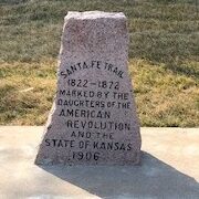
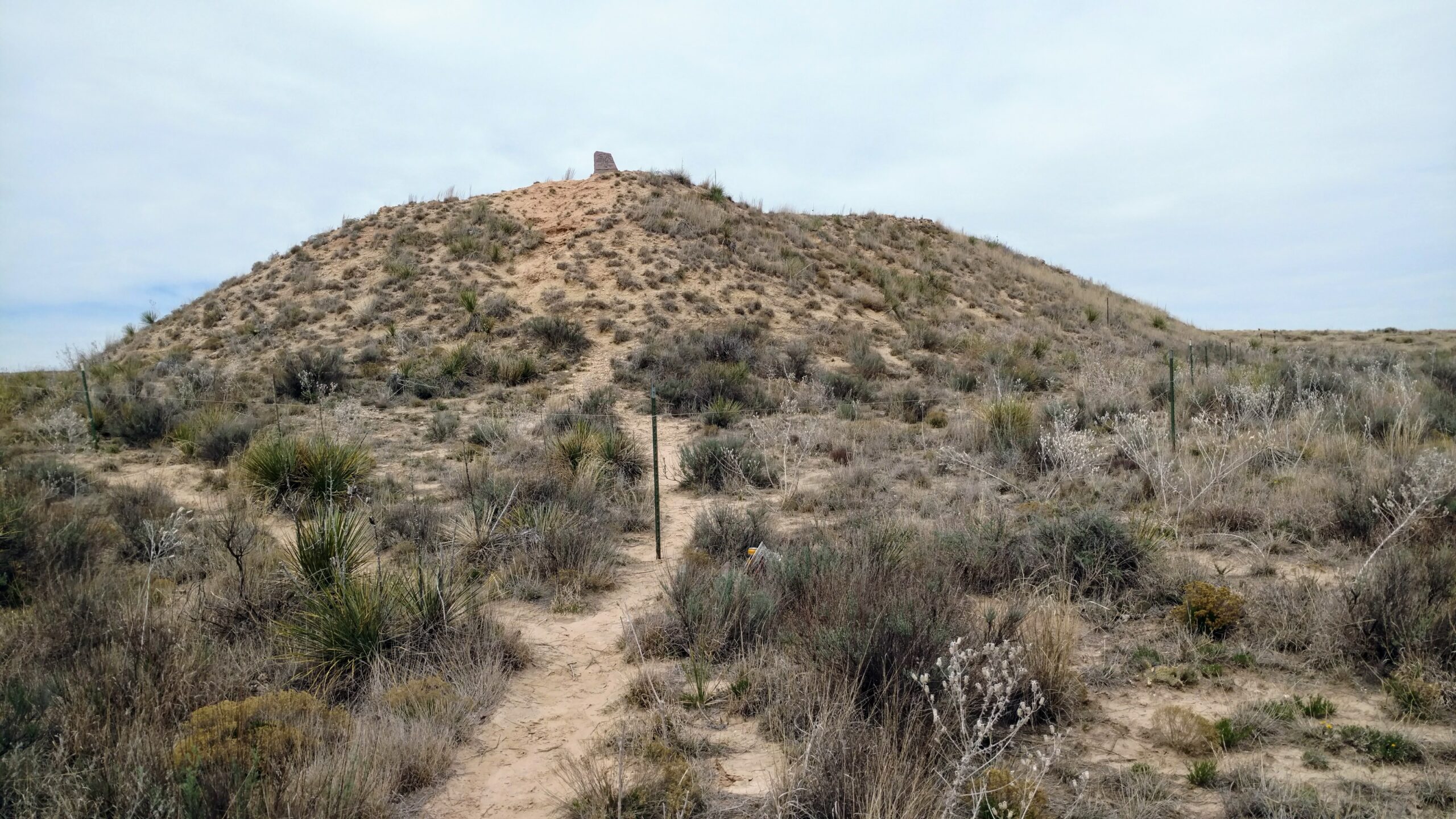
In 1941, Kansas was celebrating the 400th anniversary of the coming of Coronado to Quivira, the first white man to visit Kansas. The occasion was observed by placing historical markers all over the state. Kearny County held a Pioneer Day celebration that July, and a crowd of more than 1,000 witnessed one of the largest parades in Lakin where 10-gallon hats, cattlemen’s garb, pioneer costumes, horse riders and buckboards were abundant. Following a program at the court house, participants drove a mile west of Lakin on US 50 for more speeches, music, celebrating and the unveiling of the Chouteau Island marker. Although the original sign is long gone, a sign commemorating Chouteau’s Island can still be found just west of Lakin at the roadside park beside the golf course.

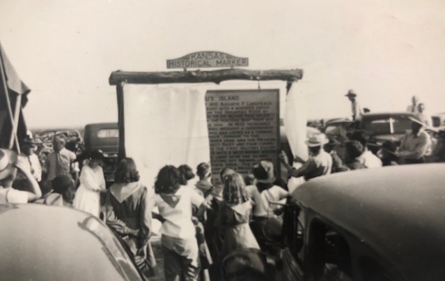
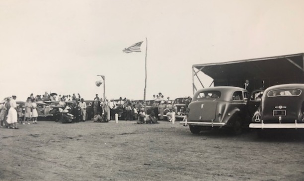
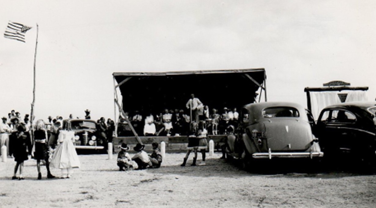
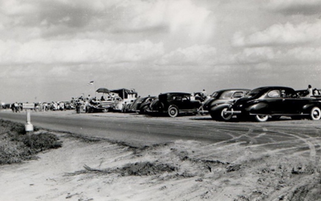
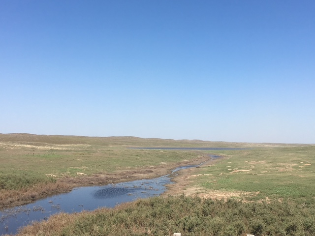
 Photos from the 1941 Chouteau’s Island marker reveal. The island once rose lush and green in the middle of the Arkansas River, its disappearance blamed on natural forces, flood control measures and the use of the Arkansas for irrigation.

SOURCES: “William Y. Hitt Santa Fe Trail Memoires,” “The Old Santa Fe Trail” by Colonel Henry Inman, “Commerce of the Prairies” by Josiah Gregg, “The Flight of Time” by Milton E. Bryan, “Kansas Before 1854: A Revised Annals” compiled by Louis Barry, “Chronicle of Bennett C. Riley” by Leo E. Oliva; History of Kearny County Vol. 1, & ancestry.com. Special thanks to Meg Nash Spellman.


The Marking of the Santa Fe Trail

By 1900, the Santa Fe Trail was already history. If asked to locate the Trail, very few people could do so. The Kansas Daughters of the American Revolution, an organization which honors our American heritage, set a plan in motion in 1902 to mark the old commerce route as a tribute to the brave pioneers who traversed it.  “Those early travelers prized the old Trail as a road to the future, and we hope the people of years to come will use it and keep its early history in remembrance.”

The DAR enlisted the aid of maps, the knowledge of early settlers, the Kansas State Historical Society and some previously erected markers to trace the route of the SFT. At a Trail Committee meeting in 1905, the Daughters decided to ask the school children of Kansas to contribute a penny each toward the marking of the Trail since the funds appropriated by the State were not enough to pay for all the markers. On Kansas Day 1906, which was also designated as Trail Day, approximately 200 pennies were collected from Lakin students to help in the endeavor.

In 1907, the DAR announced that 96 markers had been placed throughout Kansas. Kearny County’s markers arrived by rail in July of that year, and commissioners paid the expense of setting the five stones. Since Kearny County did not have a DAR chapter, County Clerk and Lakin pioneer F.L. Pierce gave prompt and efficient attention to the task of having the markers placed. The marker placed in Deerfield stands in the southeast corner of the city park. In Lakin, one monument was set at the old courthouse at the corner of Main and Waterman. This marker was moved to the current courthouse in 1939. The third marker in Lakin sits in front of the high school. It was moved to this location in 1961 but had originally been placed at the site of the school building which sat on the west end of the Lakin Grade School block.

Hartland’s Main Street was the location of the fourth marker. As Hartland gradually disappeared, the marker was engulfed in weeds. Billy Carter was cultivating the ground and put a long chain around the marker and pulled it over to his house. Later the DAR Chapter of Garden City secured the assistance of the highway commission and had the marker moved to the River Road where it intersects the once Main Street of Hartland.

The final marker was placed between Lakin and Deerfield at Long Schoolhouse. For several years after the school closed, the marker remained where it was placed by the side of the highway. As the story goes, a young man who was opening a filling station in Lakin thought the marker would look good on the station grounds and brought it to Lakin. Kearny County commissioners later instructed Paul McVey, county engineer, to move this marker to Indian Mound. Mr. McVey and Bill Fross accomplished this difficult task using a winch truck.

The dates engraved on the markers (1822-1872) are a somewhat controversial topic among trail enthusiasts as the Santa Fe Trail Association recognizes the start of the trail as 1821 when William Becknell first ventured to Santa Fe and the end of the trail as 1880 when the railroad reached Santa Fe. The Story of the Marking of the Santa Fe Trail by the Daughters of the American Revolution in Kansas and the State of Kansas claims, “The earliest use of the Trail was in 1822, when a caravan left Boonville, Mo., by way of Lexington, Independence, Westport (now Kansas City, Mo.), thence in a southwesterly direction across the great State of Kansas, then only a desert and wilderness, and on to Santa Fe, New Mexico.” The DAR correlated the end of the trail with the completion of the Atchison, Topeka & Santa Fe Railroad through Kansas in 1872. In 1996, a plea was made in the quarterly newsletter of the Santa Fe Trail Association to press for historical accuracy, but the original engraved dates remain. Nonetheless, more important than the dates on the granite markers is the fact that had the Daughters not marked the historic route when they did, the location of the Santa Fe Trail could have been lost forever.

The DAR’s Santa Fe Trail marker at Lakin High School.

SOURCES: “The Story of the Marking of the Santa Fe Trail by the Daughters of the American Revolution in Kansas and the State of Kansas” by DAR Historian Mrs. T.A. Cordry; “History of Kearny County” Vol. I; Kansapedia, Kansas State Historical Society, www.dar.com; www.santafetrailresearch.com; archives of the Advocate; Museum archives, and information provided by the late Marcella McVey.


The Santa Fe Trail through Kearny County

Indian Mound and Chouteau’s Island, both in Kearny County, were the most conspicuous landmarks on the Santa Fe Trail between Pawnee Rock and Bent’s Fort. One can only imagine the array of traders, soldiers, freighters and emigrants who passed through our ‘neck of the woods’ while traversing America’s first commercial highway.
In September of 1821, Missouri trader William Becknell left Franklin with wagonloads of cloth, buttons, buckles, tools and more. It took him and his five compadres roughly two and a half months to cross Kansas and reach Santa Fe, NM. Unlike others before him who had been arrested by Spanish soldiers, Becknell was welcomed. What was so important about Becknell’s timing? He had made it to New Mexico after the territory won its freedom from Spain. He returned to Missouri with bags of silver and glowing accounts of the profits to be made in the Santa Fe trade. Other traders soon followed suit.
By 1824, commercial trade between Missouri and New Mexico was a significant benefit to both the U.S. and Mexico. That year, the General Survey Act authorized the president to order surveys for roads and canals “of national importance, in a commercial or military point of view, or necessary for the transportation of public mail.” President James Monroe assigned responsibility for the surveys to the Corps of Engineers. The act provided $10,000 for marking the Santa Fe Trail and $20,000 for implementing right-of-way treaties with Native American tribes whose land touched the route. The Sibley Expedition began the nearly two-year endeavor in July of 1825.
There were two routes to the Santa Fe Trail, the Cimarron Route and the Mountain Route. Just west of Dodge City, some traders crossed the Arkansas River at the middle crossing to take a shortcut called the Cimarron Cut-off or the Jornada. This route was very dangerous because it passed through Indian hunting grounds and very little water was available. Wagons that did not take the Cimarron Cut-off continued west beside the Arkansas River, eventually arriving in what is now Kearny County. Here, caravans had two choices – continue west and take the treacherous mountain route which offered more water and fewer Indian dangers or use the upper crossing, turning near Chouteau’s Island and traveling the Bear Creek Pass.
According to field notes by U.S. Engineer Joseph C. Brown, a member of the Sibley Expedition, “The road is again very good up to Chouteau’s Island – the largest island of timber on the river. Many things unite to mark the place so strongly that the traveler will not mistake it … On the north side of the river the hills approach tolerable nigh and on (one) of them a sort of mound conspicuous some miles distance. . . The course of the river likewise being more south identify the place.”
Indian Mound, about five miles west of Lakin, overlooked Chouteau’s Island. Speculation regarding the origin of the mound is longstanding. Was it manmade or a phenomenon of nature? Whatever the case may be, Indian Mound offered a vantage point to both settlers and Native Americans on the lookout for approaching parties. Wind and rain have eroded the mound considerably.
Chouteau’s Island once rose lush and green in the middle of the Arkansas River. Its disappearance is blamed on natural forces, flood control measures and the use of the Arkansas for irrigation. The island was named for Auguste P. Chouteau whose hunting party entrenched themselves on the island in 1816 and successfully fought off an attack of 200 Pawnee Indians.
Wagon trains turned south at Chouteau’s Island and skirted the small but very deep Clear Lake, noted by Brown as a large pond slightly to the east. They then followed Bear Creek Pass, a natural passageway through the sand hills created by a slippage in the Cretaceous Formation around 250,000 years ago. According to geologists, a stream flowed through Bear Creek into the Arkansas River, but dry periods led to the sand blowing over the water and the stream going underground. This theory rings true with what is known of Sunken Wells, a watering hole and stopover point near the Kearny-Grant county line. Stories tell how travelers would stop for the night in the dry sand hills with no water in sight. They would wake in the morning and were surprised to find large cracks in the earth near where they had been sleeping and a lake of water, 200 feet or more in diameter. Within a few hours, the lake would disappear. From this southern end of the Bear Creek Pass, travelers struck a due south course until meeting up with the Cimarron Cut-off at the lower spring (Wagon Bed Springs) in what is now Grant County.
By 1825, goods from Missouri were not only being traded in Santa Fe but also to other points farther south. In 1828 alone, $150,000 of merchandise was taken to Santa Fe. By that time, Independence, MO had become the starting point of the trail. The trail was used primarily as a commercial road between 1821 and 1880 and quickly became a route of cultural exchange. A few months into the Mexican-American War in 1846, America’s Army of the West followed the Santa Fe Trail westward to successfully invade Mexico. Following the Treaty of Guadalupe Hidalgo which ended the war in 1848, the Santa Fe Trail became a national road connecting the more settled parts of the United States to the new southwest territories. According to the National Park Service, commercial freighting along the trail boomed to unheard-of levels, including considerably large amounts of military freighters who were supplying the southwestern forts. The trail was also used by thousands of gold seekers heading to Colorado and California, stagecoach lines, adventurers, missionaries, wealthy New Mexican families and emigrants.
Railroads began expanding westward across Kansas when the Civil War ended. Shipping goods by train was faster and easier, and the lengths that traders had to travel on the trail grew shorter. The glory days of the oldest and most important overland trade route across the Great Plains were over when the Atchison, Topeka and Santa Fe Railroad reached Santa Fe in 1880.
SOURCES: National Park Service; Santa Fe Trail Association; “Bear Creek Pass and the Santa Fe Trail” by Dorothy Morgan; History of Kearny County Vol. 1, and Museum archives.
Map courtesy of the Santa Fe Trail Association.
Photo of Indian Mound provided by Jason Harrison whose 2017 Eagle Scout project involved making improvements to the site which included the installation of the Santa Fe National Historic Trail sign.
A lone angler tries his luck at Clear Lake in this photo from an article by the late Dorothy Morgan which appeared in the Santa Fe Trail Association’s August 1997 Wagon Tracks.
Now only a slight depression, Sunken Wells on the south end of Bear Creek Pass can be seen from Highway 25 when traveling from Lakin to Ulysses. This photo was taken in 2018 after heavy rains filled the area.